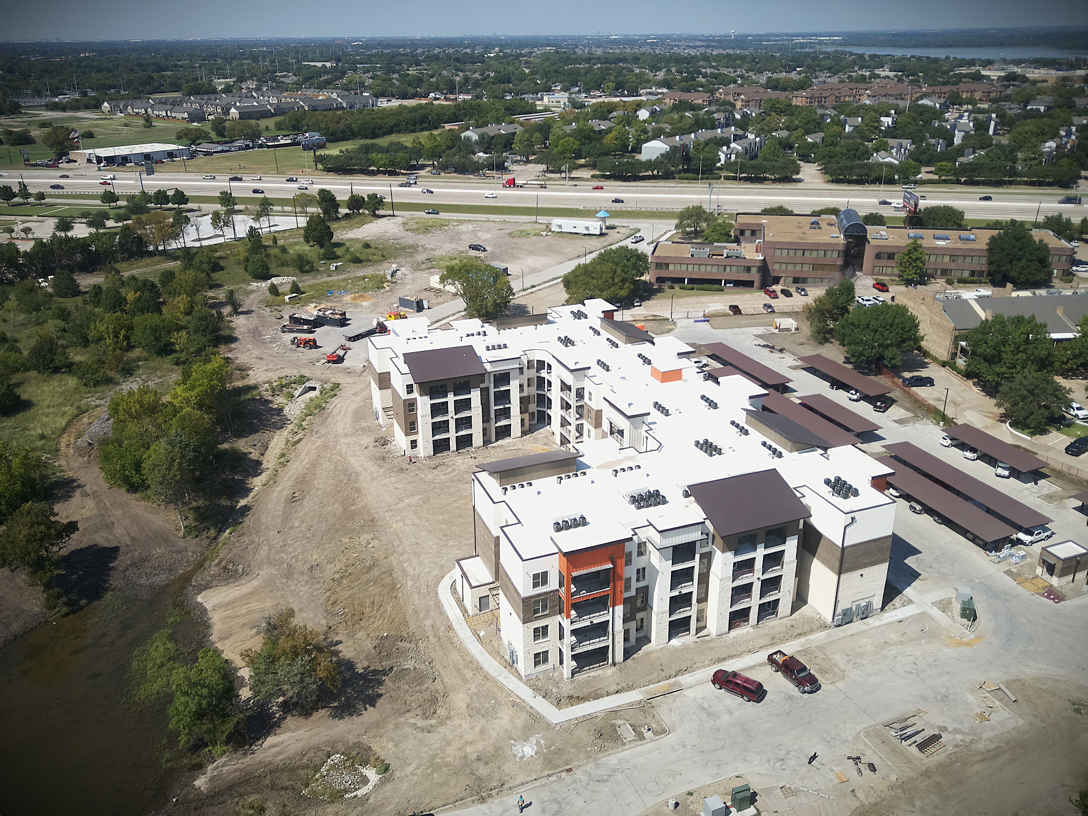
See progress without walking the whole site.
High‑resolution RGB flyovers, stitched site maps, and shareable recaps for owners, OAC meetings, and field crews—so everyone stays aligned.
What you get after a visit
Clear visuals you can drop into OAC decks or emails. Each visit includes a stitched site map, consistent progress photos, and a simple recap anyone can open.
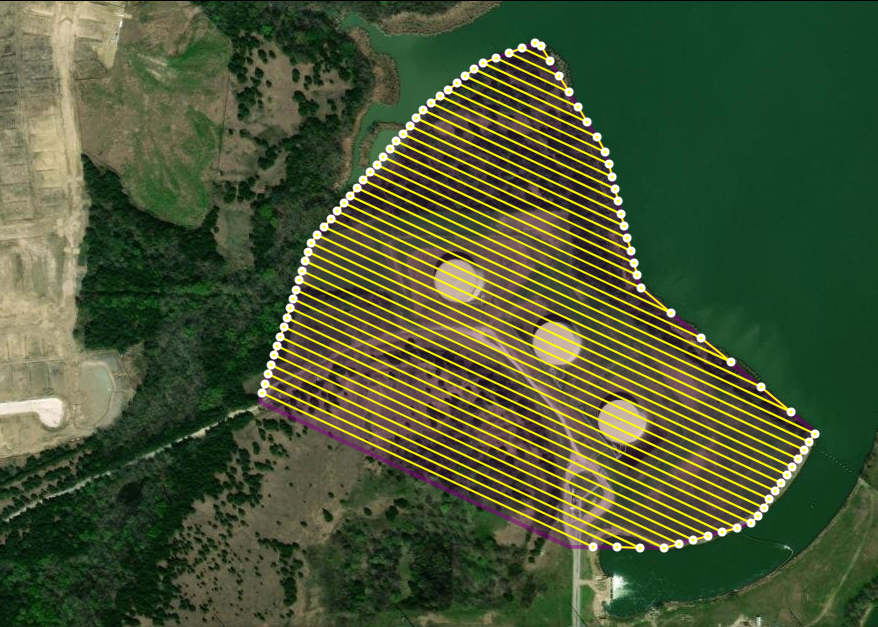
Orthomosaic site map (RGB)
See the whole job at once and zoom into trouble spots. Great for weekly tracking and coordination.
Consistent progress photos
We re‑fly the same vantage points each week—steel, envelope, MEP areas, sitework—so changes are obvious.
Shareable owner update
A one‑page PDF with dates, map snapshots, and highlights—plus a web link. No special software needed.
Where it helps right now
Weekly progress
Framing, envelope, MEP rough‑in, paving, landscaping—clear visuals for OAC.
Laydown & logistics
Staging areas, crane pads, delivery routes, and material flow at a glance.
Storm & housekeeping
Standing water, silt fence breaks, debris piles—see it, note it, act on it.
Perimeter & access
Gates, fencing, and clean approaches—quick checks that save time on walk‑throughs.
Punch‑list context
Annotated photos to support RFIs and deficiency tracking.
Marketing updates
Attractive aerials for stakeholders and PR without extra site work.
How it works
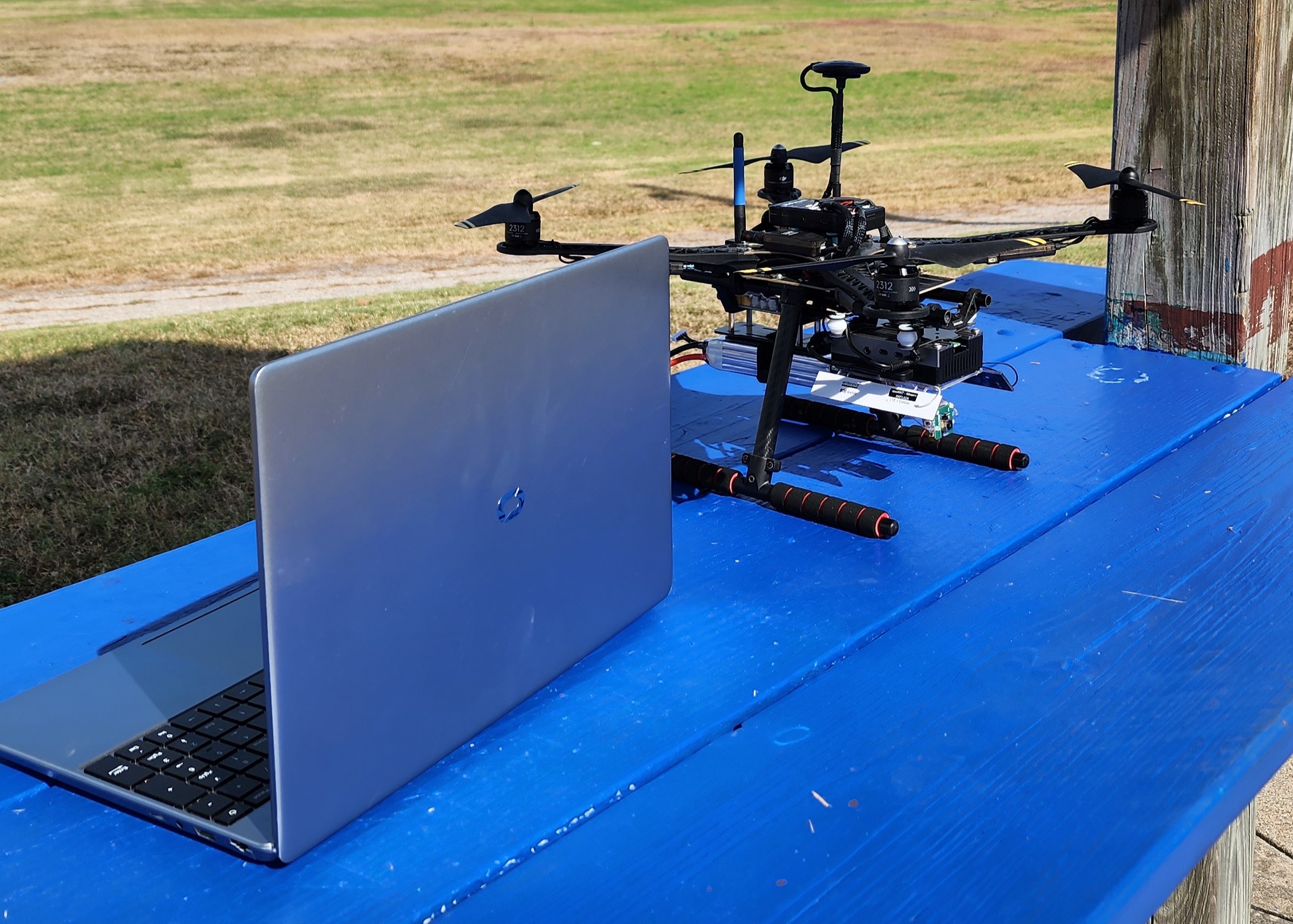
1) Plan & fly
Agree on key vantage points and a repeatable route. We fly at a consistent height with high overlap.
2) Process & map
Images are stitched into an orthomosaic and aligned to standard GPS. We flag areas of interest.
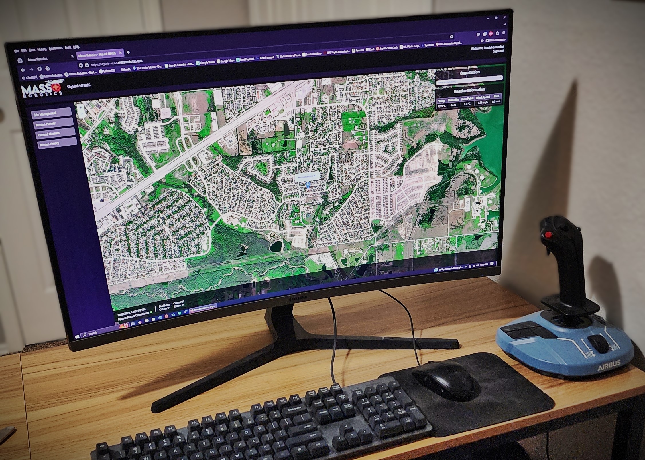
3) Deliver & follow up
You get a web link, a one‑page PDF recap, and the photo set. Re‑fly weekly or after weather events to track change.
Deliverables & formats
Standard
- • Web map link (works in any browser)
- • One‑page PDF recap (dates, highlights, map snapshots)
- • Geo‑tagged photo set (JPEGs by date/location)
On request
- • Orthophoto export (GeoTIFF)
- • KML/KMZ for Google Earth
- • Basic relative elevation surface (for drainage/ponding context)
Note: GeoTIFFs can be large; we’ll advise the easiest way to open and share based on your device/software.
Accuracy & transparency
RGB today: Excellent for visual tracking and coordination. Positioning is comparable to smartphone GPS.
Comparisons over time: We re‑fly the same routes and vantage points so features line up week to week.
Not for legal measurements/as‑builts: Without RTK/GCPs this is not survey‑grade. We’ll add those workflows as hardware comes online.
What’s next
RTK & GCPs
Ground control and RTK for precise alignment and survey‑grade overlays.
Thermal (select use cases)
Roofing/envelope checks and water intrusion indicators where appropriate.
360° aerial panoramas
Quick orientation views for stakeholders and remote teams.
Ready to fly your site?
Tell us about your schedule and access. We’ll propose a simple, repeatable flight plan.